Bild:Map of the Western Cape with Cape Town highlighted (2011).svg

Größe der PNG-Vorschau dieser SVG-Datei: 753 × 600 Pixels. Anner Oplösungen: 302 × 240 Pixels | 603 × 480 Pixels | 965 × 768 Pixels | 1.280 × 1.019 Pixels | 2.560 × 2.038 Pixels | 849 × 676 Pixels.
Originaldatei (SVG-Datei, Utgangsgrött: 849 × 676 Pixel, Dateigrött: 341 KB)
| Disse Datei warrt direkt vun Wikimedia Commons inbunnen. Angaven to'n Autor un de Lizenz staht op de Sied to de Datei bi Commons. |
.svg)
Beschrieven
| Beschrievung |
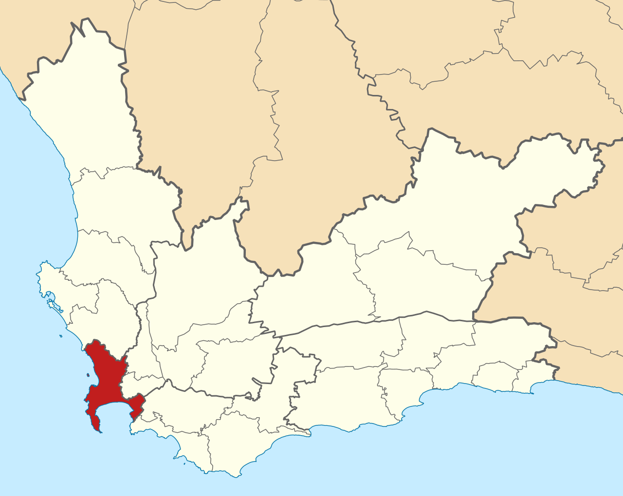
English: Map of municipal boundaries in the Western Cape, as they will be after the municipal elections of 18 May 2011, with the City of Cape Town Metropolitan Municipality highlighted in red. Based on File:Map of the Western Cape with municipalities blank (2011).svg. |
| Datum/Tiet | |
| Born | Egen Wark |
| Autor | Htonl |
.svg)
Lizenz
Ik, Autor vun disse Datei, geev ehr hiermit ünner disse Lizenzen free:

|
Ünner de Maatgaven vun de GNU free Lizenz för Dokumentatschoon, Version 1.2 oder en latere Version, rutgeven vun de Free Software Foundation;, dörffst du disse Datei koperen, wiedergeven un/oder ännern; dat gifft keene unverännerlichen Afsneed un keen Ümslagtext vörn oder achtern. Den fullen Text vun den Afspraak is in't Kapitel GNU-Afspraak för friee Dokumentaschion verfögbar. |
Diese Datei ist unter den Creative Commons-Lizenzen Namensnennung – Weitergabe unter gleichen Bedingungen 4.0 International, 3.0 nicht portiert, 2.5 Allgemein, 2.0 Allgemein und 1.0 Allgemein lizenziert.
- Du dröffst:
- wiedergeven – Kopien maken, an Annere wiedergeven un överdregen
- nee tohoopsetten – dat Wark verännern
- Ünner disse Bedingen:
- Naam nömen – Du musst den Naam von’n Autor oder von’n Afspraakgever in de von em fastleggte Wies nömen (aver nich so, dat dat utsüht, as wenn he di oder dien Gebruuk von dat Wark ünnerstütten deit).
- egaal wiedergeven – Wenn du dit Wark ännerst, afwannelst oder in en eegen Wark inboost, dörffst du dat nie’e Wark, dat dor bi rutkummt, man ünner desülve Afspraak oder een, de so temlich dat sülve is, rutgeven.
Du kannst di de Lizenz utsöken, de di opbest gefallt.
Datei-Historie
Klick op de Tiet, dat du de Datei ankieken kannst, so as se do utseeg.
| Datum/Tiet | Duumnagelbild | Grött | Bruker | Kommentoor | |
|---|---|---|---|---|---|
| aktuell | 17:20, 7. Apr. 2011 | | 849 × 676 (341 KB) | Htonl | {{Information |Description ={{en|1=Map of municipalities in the Western Cape, as they will be after the municipal elections of 18 May 2011], with the [[w:City of Cape Town|City of Cape |
Dateibruuk
Disse Sied bruukt dit Bild:
Allmeen Datei-Bruuk
Disse annern Wikis bruukt disse Datei:
- Bruuk op af.wikipedia.org
- Bruuk op ceb.wikipedia.org
- Bruuk op en.wikipedia.org
- Bruuk op es.wikipedia.org
- Bruuk op fr.wikipedia.org
- Bruuk op id.wikipedia.org
- Bruuk op it.wikivoyage.org
- Bruuk op ko.wikipedia.org
- Bruuk op www.wikidata.org
- Bruuk op zh-min-nan.wikipedia.org
- Bruuk op zu.wikipedia.org
.svg)