Bild:Bull Pass - Antarctica.jpg
Grött vun disse Vörschuu: 800 × 600 Pixels. Anner Oplösungen: 320 × 240 Pixels | 640 × 480 Pixels | 1.024 × 768 Pixels | 1.280 × 960 Pixels | 1.600 × 1.200 Pixels.
Originaldatei (1.600 × 1.200 Pixel, Grött: 127 KB, MIME-Typ: image/jpeg)
| Disse Datei warrt direkt vun Wikimedia Commons inbunnen. Angaven to'n Autor un de Lizenz staht op de Sied to de Datei bi Commons. |
Beschrieven
| Beschrievung |
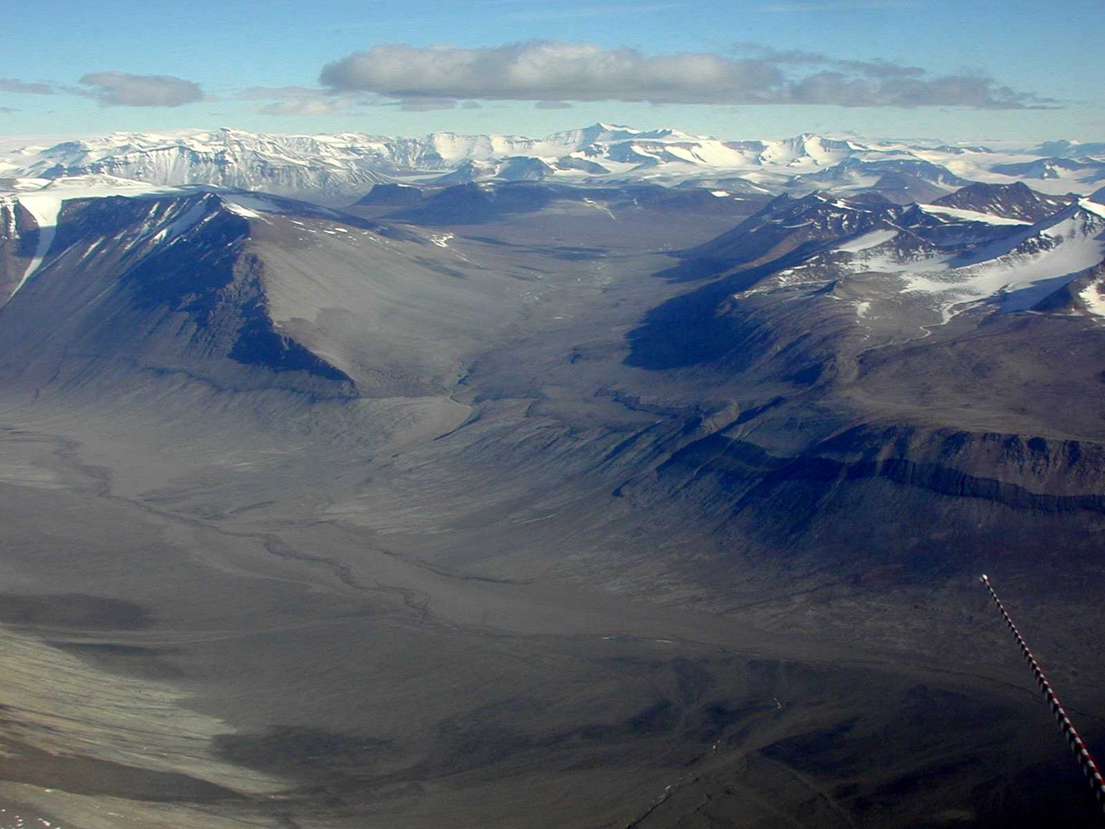
English: Bull Pass in the Dry Valleys of southern Victoria Land. The Dry Valleys extend over 1,500 square miles and are mostly devoid of snow and ice. |
| Datum/Tiet | |
| Born | Antarctic Photo Library, U.S. Antarctic Program |
| Autor | NSF/Josh Landis, employee 1999-2001 |
| Standoort Kamera | | Dit un anner Biller an de Steed op: OpenStreetMap |
|---|
Lizenz
| This image is a work of a National Science Foundation employee, taken or made as part of that person's official duties. As a work of the U.S. federal government, the image is in the public domain. |  |
Datei-Historie
Klick op de Tiet, dat du de Datei ankieken kannst, so as se do utseeg.
| Datum/Tiet | Duumnagelbild | Grött | Bruker | Kommentoor | |
|---|---|---|---|---|---|
| aktuell | 21:14, 13. Mär 2007 | | 1.600 × 1.200 (127 KB) | Eugene van der Pijll | Bull Pass - Antarctica Source: Antarctic Photo Library, U.S. Antarctic Program [http://photolibrary.usap.gov/Portscripts/PortWeb.dll?query&field1=Filename&op1=matches&value=Bullpa1.jpg&catalog=Antarctica&template=USAPgovMidThumbs] Photograph by: Josh La |
Dateibruuk
Disse Sieden bruukt dit Bild:
Allmeen Datei-Bruuk
Disse annern Wikis bruukt disse Datei:
- Bruuk op ar.wikipedia.org
- Bruuk op ca.wikipedia.org
- Bruuk op ceb.wikipedia.org
- Bruuk op da.wikipedia.org
- Bruuk op de.wikipedia.org
- Bruuk op en.wikipedia.org
- Bruuk op eo.wikipedia.org
- Bruuk op eu.wikipedia.org
- Bruuk op he.wikipedia.org
- Bruuk op it.wikivoyage.org
- Bruuk op ja.wikipedia.org
- Bruuk op lld.wikipedia.org
- Bruuk op mk.wikipedia.org
- Bruuk op nn.wikipedia.org
- Bruuk op no.wikipedia.org
- Bruuk op pl.wikipedia.org
- Bruuk op pt.wikipedia.org
- Bruuk op ro.wikipedia.org
- Bruuk op ru.wikipedia.org
- Bruuk op www.wikidata.org