Bild:India location map2.svg

Größe der PNG-Vorschau dieser SVG-Datei: 557 × 600 Pixels. Anner Oplösungen: 223 × 240 Pixels | 446 × 480 Pixels | 713 × 768 Pixels | 951 × 1.024 Pixels | 1.902 × 2.048 Pixels | 1.500 × 1.615 Pixels.
Originaldatei (SVG-Datei, Utgangsgrött: 1.500 × 1.615 Pixel, Dateigrött: 1,69 MB)
| Disse Datei warrt direkt vun Wikimedia Commons inbunnen. Angaven to'n Autor un de Lizenz staht op de Sied to de Datei bi Commons. |

|
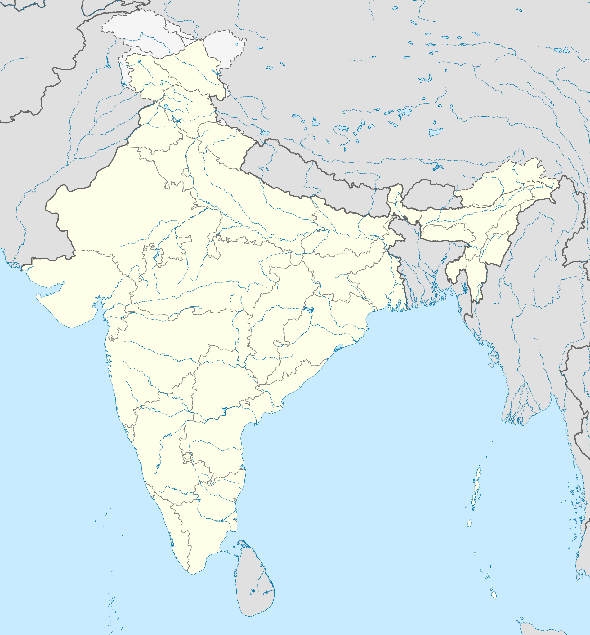
The boundaries on this map show the de facto situation. This is just one of several different views on the subject (see COM:NPOV). |
Beschrieven
| Beschrievung |
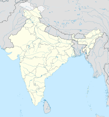
English: Location map of India. Equirectangular projection. Strechted by 106.0%. Geographic limits of the map: * N: 37.5° N * S: 5.0° N * W: 67.0° E * E: 99.0° E Made with Natural Earth. Free vector and raster map data @ naturalearthdata.com. |
| Datum/Tiet | |
| Born | Eigenes Werk, basierend auf: File:India location map.svg von Uwe Dedering at de:Wp |
| Autor | AshwiniKalantri |
| Annere Versionen |
[]
|
| SVG‑Erstellung | De Borntext von Dit Vektorbild is mit Adobe Illustrator opstellt worrn, und mit Inkscape. |


Lizenz
Ik, Autor vun disse Datei, geev ehr hiermit ünner disse Lizenzen free:
Disse Datei is verfögbar ünner de Creative Commons Attribution-Share Alike 3.0 Unported Afspraak.
- Du dröffst:
- wiedergeven – Kopien maken, an Annere wiedergeven un överdregen
- nee tohoopsetten – dat Wark verännern
- Ünner disse Bedingen:
- Naam nömen – Du musst den Naam von’n Autor oder von’n Afspraakgever in de von em fastleggte Wies nömen (aver nich so, dat dat utsüht, as wenn he di oder dien Gebruuk von dat Wark ünnerstütten deit).
- egaal wiedergeven – Wenn du dit Wark ännerst, afwannelst oder in en eegen Wark inboost, dörffst du dat nie’e Wark, dat dor bi rutkummt, man ünner desülve Afspraak oder een, de so temlich dat sülve is, rutgeven.
Disse Datei is freegeven ünner de Creative-Commons-Lizenz NaamDorbi-EgaleWiedergaav 3.0 Düütschland.
- Du dröffst:
- wiedergeven – Kopien maken, an Annere wiedergeven un överdregen
- nee tohoopsetten – dat Wark verännern
- Ünner disse Bedingen:
- Naam nömen – Du musst den Naam von’n Autor oder von’n Afspraakgever in de von em fastleggte Wies nömen (aver nich so, dat dat utsüht, as wenn he di oder dien Gebruuk von dat Wark ünnerstütten deit).
- egaal wiedergeven – Wenn du dit Wark ännerst, afwannelst oder in en eegen Wark inboost, dörffst du dat nie’e Wark, dat dor bi rutkummt, man ünner desülve Afspraak oder een, de so temlich dat sülve is, rutgeven.


|
Ünner de Maatgaven vun de GNU free Lizenz för Dokumentatschoon, Version 1.2 oder en latere Version, rutgeven vun de Free Software Foundation;, dörffst du disse Datei koperen, wiedergeven un/oder ännern; dat gifft keene unverännerlichen Afsneed un keen Ümslagtext vörn oder achtern. Den fullen Text vun den Afspraak is in't Kapitel GNU-Afspraak för friee Dokumentaschion verfögbar. |
Du kannst di de Lizenz utsöken, de di opbest gefallt.
Ursprüngliches Datei-Logbuch
This image is a derivative work of the following images:
- File:India location map.svg licensed with Cc-by-sa-3.0, Cc-by-sa-3.0-de, GFDL
- 2011-01-18T16:10:27Z Uwe Dedering 1500x1615 (2478400 Bytes) Reverted to version as of 15:50, 17 January 2011 and again, layer structure destroyed, and first discuss this!
- 2011-01-17T19:04:20Z AshwiniKalantri 1500x1615 (1593649 Bytes) The disputed land of Kashmir are shown in a different shade.
- 2011-01-17T15:50:03Z Uwe Dedering 1500x1615 (2478400 Bytes) Reverted to version as of 11:34, 22 September 2010 vandalism
- 2011-01-16T23:30:30Z AshwiniKalantri 1500x1615 (2104259 Bytes) {{Information |Description=Location Map of India |Source= |Date= |Author= |Permission= |other_versions= }}
- 2010-09-22T11:34:41Z BishkekRocks 1500x1615 (2478400 Bytes) The area north of the Siachen Glacier is also part of Chinese-controlled Kashmir.
- 2010-08-31T16:36:47Z Uwe Dedering 1500x1615 (2412750 Bytes) Coloured Pakistani-controlled parts of Kashmir in dark grey & Chinese-controlled Kashmir also. no reason to treat them differently.
- 2010-08-31T11:26:31Z AnonyLog 1500x1615 (2104259 Bytes) A lighter shade is used for uniformity with other maps of India and Pakistan on Wikipedia.
- 2010-05-05T16:44:39Z Uwe Dedering 1500x1615 (2412750 Bytes) Reverted to version as of 12:26, 3 March 2010 make them dark-grey if you wish....
- 2010-05-05T15:43:19Z BishkekRocks 1500x1615 (2104259 Bytes) Coloured Pakistani-controlled parts of Kashmir in light grey (like Chinese-controlled Kashmir). Alternatively colour both in dark grey, no reason to treat them differently.
- 2010-03-03T12:26:13Z Uwe Dedering 1500x1615 (2412750 Bytes) {{Information |Description={{en|Location map of India. Equirectangular projection. Strechted by 106.0%. Geographic limits of the map: * N: 37.5° N * S: 5.0° N * W: 67.0° E * E: 99.0° E Made with Natural Earth. Free vector
Hochgeladen mit derivativeFX
Datei-Historie
Klick op de Tiet, dat du de Datei ankieken kannst, so as se do utseeg.
| Datum/Tiet | Duumnagelbild | Grött | Bruker | Kommentoor | |
|---|---|---|---|---|---|
| aktuell | 15:48, 14. Okt. 2020 | | 1.500 × 1.615 (1,69 MB) | NordNordWest | upd Telangana/Andhra Pradesh |
| 12:58, 2. Nov. 2019 |  | 1.500 × 1.615 (1,65 MB) | NordNordWest | upd Jammu and Kashmir | |
| 10:59, 3. Jun. 2014 |  | 1.500 × 1.615 (1,63 MB) | NordNordWest | + Telangana | |
| 14:58, 11. Jun. 2012 |  | 1.500 × 1.615 (1,54 MB) | NordNordWest | adding waterbodies | |
| 22:30, 25. Feb. 2011 |  | 1.500 × 1.615 (1,57 MB) | AshwiniKalantri | {{Information |Description={{en|Location map of India. Equirectangular projection. Strechted by 106.0%. Geographic limits of the map: * N: 37.5° N * S: 5.0° N * W: 67.0° E * E: 99.0° E Made with Natural Earth. Free vector and raster map data @ natural |
Dateibruuk
Allmeen Datei-Bruuk
Disse annern Wikis bruukt disse Datei:
- Bruuk op als.wikipedia.org
- Bruuk op as.wikipedia.org
- Bruuk op az.wikipedia.org
- Bruuk op bh.wikipedia.org
- Bruuk op de.wikipedia.org
- Indien
- Varanasi
- Bhopal
- Taj Mahal
- Rajgir
- Dharamsala
- Neu-Delhi
- Mumbai
- Kolkata
- Darjeeling (Stadt)
- Prayagraj
- Ahmedabad
- Chandigarh
- Amritsar
- Chennai
- Bengaluru
- Tharangambadi
- Qadian
- Hyderabad (Indien)
- Kozhikode
- Agartala
- Pune
- Agra
- Auroville
- Hampi
- Sarnath
- Jaipur
- Leh
- Katastrophe von Bhopal
- Mahe (Indien)
- Deoband
- Srinagar
- Vrindavan
- Velha Goa
- Patna
- Bodhgaya
- Madurai
Kiek na mehr almeen Bruuk von disse Datei.