Bild:Map of Iowa highlighting Lee County.svg

Größe der PNG-Vorschau dieser SVG-Datei: 800 × 524 Pixels. Anner Oplösungen: 320 × 210 Pixels | 640 × 419 Pixels | 1.024 × 671 Pixels | 1.280 × 838 Pixels | 2.560 × 1.677 Pixels | 5.350 × 3.504 Pixels.
Originaldatei (SVG-Datei, Utgangsgrött: 5.350 × 3.504 Pixel, Dateigrött: 43 KB)
| Disse Datei warrt direkt vun Wikimedia Commons inbunnen. Angaven to'n Autor un de Lizenz staht op de Sied to de Datei bi Commons. |
Beschrieven
| Beschrievung |
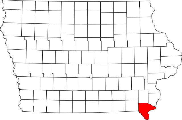
English: This is a locator map showing Lee County in Iowa. For more information, see Commons:United States county locator maps. |
| Datum/Tiet | |
| Born |
Egen Wark: English: The maps use data from nationalatlas.gov, specifically countyp020.tar.gz on the Raw Data Download page. The maps also use state outline data from statesp020.tar.gz. The Florida maps use hydrogm020.tar.gz to display Lake Okeechobee. |
| Autor | David Benbennick |
Lizenz
| Ich, der Urheberrechtsinhaber dieses Werkes, veröffentliche es als gemeinfrei. Dies gilt weltweit. Wenn dat na lokale Rechtslaag nich mööglich is, gellt: Ich gewähre jedem das bedingungslose Recht, dieses Werk für jedweden Zweck zu nutzen, es sei denn, Bedingungen sind gesetzlich erforderlich. |
Datei-Historie
Klick op de Tiet, dat du de Datei ankieken kannst, so as se do utseeg.
| Datum/Tiet | Duumnagelbild | Grött | Bruker | Kommentoor | |
|---|---|---|---|---|---|
| aktuell | 14:15, 12. Feb. 2006 | | 5.350 × 3.504 (43 KB) | David Benbennick | {{subst:User:Dbenbenn/clm|county=Lee County|state=Iowa}} |
Dateibruuk
Disse Sied bruukt dit Bild:
Allmeen Datei-Bruuk
Disse annern Wikis bruukt disse Datei:
- Bruuk op ar.wikipedia.org
- Bruuk op azb.wikipedia.org
- Bruuk op bg.wikipedia.org
- Bruuk op bpy.wikipedia.org
- Bruuk op cdo.wikipedia.org
- Bruuk op ceb.wikipedia.org
- Bruuk op ce.wikipedia.org
- Bruuk op cy.wikipedia.org
- Bruuk op de.wikipedia.org
- Bruuk op en.wikipedia.org
- List of counties in Iowa
- Lee County, Iowa
- Donnellson, Iowa
- Fort Madison, Iowa
- Franklin, Iowa
- Houghton, Iowa
- Keokuk, Iowa
- Montrose, Iowa
- St. Paul, Iowa
- West Point, Iowa
- Fort Madison Toll Bridge
- Keokuk National Cemetery
- Lock and Dam No. 19
- Template:Lee County, Iowa
- George M. Verity (towboat)
- Atchison, Topeka and Santa Fe Passenger and Freight Complex Historic District
- Denmark, Iowa
- Argyle, Iowa
- Pilot Grove, Iowa
- Wever, Iowa
- National Register of Historic Places listings in Lee County, Iowa
- New Boston, Iowa
- Fort Madison Downtown Commercial Historic District
- Faeth Farmstead and Orchard District
- Charleston, Iowa
- User:Nyttend/County templates/IA/2
Kiek na mehr almeen Bruuk von disse Datei.