Bild:Vinson-Map.jpg

Grött vun disse Vörschuu: 626 × 599 Pixels. Anner Oplösungen: 251 × 240 Pixels | 501 × 480 Pixels | 802 × 768 Pixels | 1.070 × 1.024 Pixels | 2.139 × 2.048 Pixels | 3.207 × 3.070 Pixels.
Originaldatei (3.207 × 3.070 Pixel, Grött: 5,48 MB, MIME-Typ: image/jpeg)
| Disse Datei warrt direkt vun Wikimedia Commons inbunnen. Angaven to'n Autor un de Lizenz staht op de Sied to de Datei bi Commons. |
| Beschrievung |
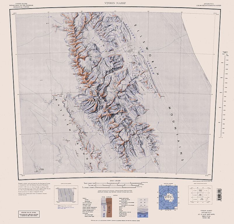
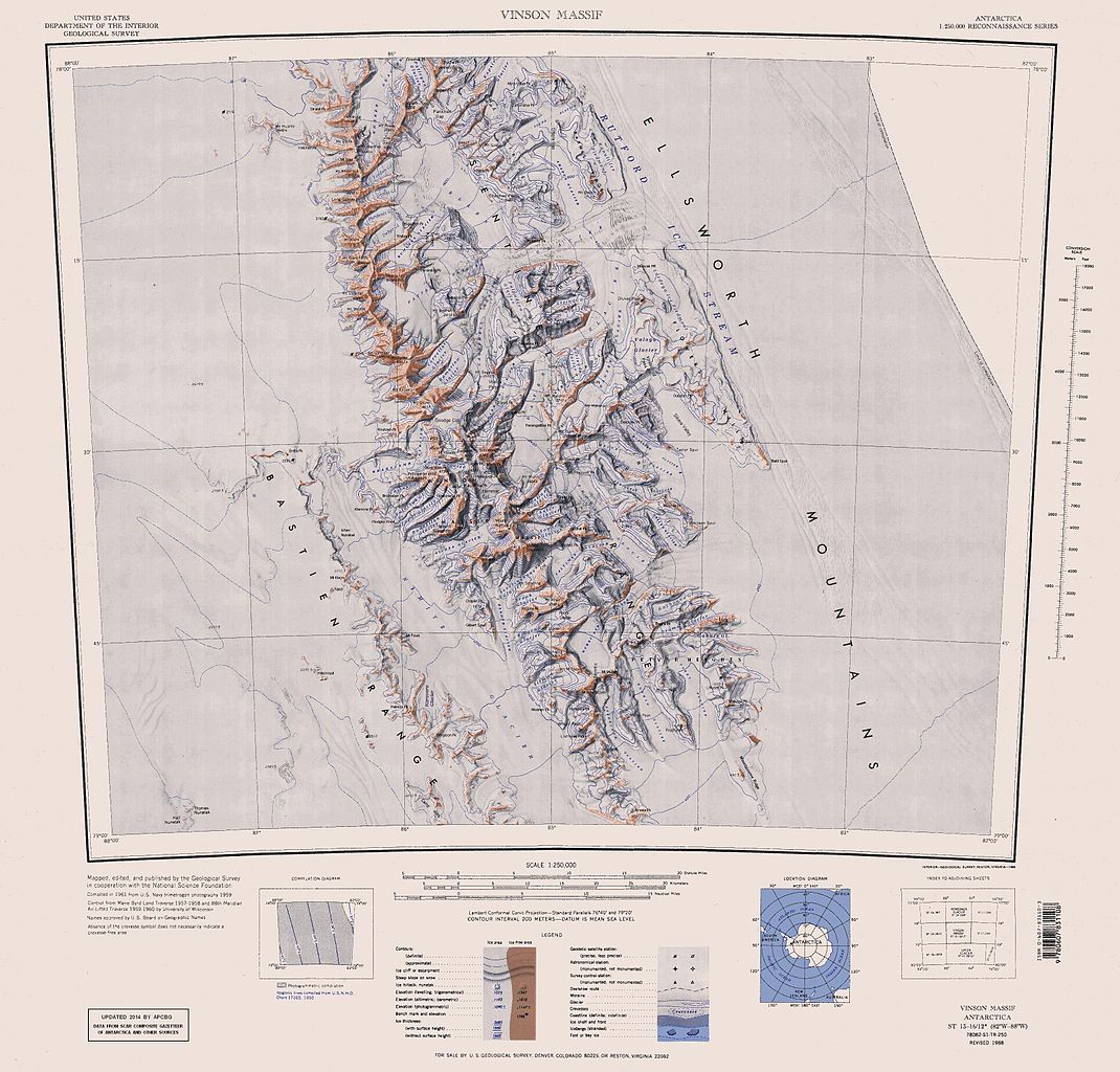
English: Map of Antarctica by the United States Antarctic Resource Center of the US Geological Survey (USGS). |
| Datum/Tiet | |
| Born | https://usarc.usgs.gov/drgs/dir1/c78082s1.jpg |
| Autor | United States Department of the Interior: Geological Survey |
| Annere Versionen |
Trimmed and updated version of Wikimedia Commons Image:C78082s1_Ant.Map_Vinson_Massif.jpg. |
Dieses Bild ist gemeinfrei (public domain), weil es Materialien beeinhaltet, die ursprünglich vom United States Geological Survey, einer Behörde des Innenministeriums der Vereinigten Staaten, stammen. Weitere Informationen finden Sie in den Urheberrechtsbestimmungen des USGS
|
Datei-Historie
Klick op de Tiet, dat du de Datei ankieken kannst, so as se do utseeg.
| Datum/Tiet | Duumnagelbild | Grött | Bruker | Kommentoor | |
|---|---|---|---|---|---|
| aktuell | 18:25, 22. Jan. 2014 | | 3.207 × 3.070 (5,48 MB) | Apcbg | Updated with data from SCAR Composite Gazetteer of Antarctica and other sources. |
| 09:11, 27. Aug. 2013 |  | 3.207 × 3.070 (5,47 MB) | Apcbg | Updated with data from SCAR Composite Gazetteer of Antarctica and other sources. | |
| 18:34, 9. Jul. 2011 |  | 3.207 × 3.070 (5,46 MB) | Apcbg | Updated with data from SCAR Composite Gazetteer of Antarctica and other sources. | |
| 19:34, 8. Mär 2011 |  | 3.207 × 3.070 (5,47 MB) | Apcbg | Updated with data from SCAR Composite Gazetteer of Antarctica and other sources. | |
| 18:52, 13. Okt. 2010 |  | 3.207 × 3.070 (5,45 MB) | Apcbg | Updated with data from SCAR Composite Gazetteer of Antarctica and other sources. | |
| 12:27, 30. Jan. 2007 |  | 3.207 × 3.070 (5,4 MB) | Apcbg | Map of Antarctica by the United States Antarctic Ressource Center of the US Geological Society. Trimmed version of Wikimedia image C78082s1_Ant.Map_Vinson_Massif.jpg {{PD-US}} Copyrights and Trademarks USGS-authored or produced data and information are |
Dateibruuk
Disse Sieden bruukt dit Bild:
Allmeen Datei-Bruuk
Disse annern Wikis bruukt disse Datei:
- Bruuk op ar.wikipedia.org
- Bruuk op ast.wikipedia.org
- Bruuk op az.wikipedia.org
- Mirovyane zirvəsi
- Zimornitsa zirvəsi
- Fuça zirvəsi
- Bezden zirvəsi
- Oreşak zirvəsi
- Qolemani zirvəsi
- Marsa buzlağı
- Patleyna buzlağı
- Embree buzlağı
- Kopsis buzlağı
- Padala buzlağı
- Ellen buzlağı
- Fonfon buzlağı
- Gerila buzlağı
- Rumyana buzlağı
- Delyo buzlağı
- Burdenis buzlağı
- Arapya buzlağı
- Pulpudeva buzlağı
- Mamarçev zirvəsi
- Rutford
- Bruuk op bg.wikipedia.org
- Bruuk op ca.wikipedia.org
- Bruuk op ceb.wikipedia.org
Kiek na mehr almeen Bruuk von disse Datei.