Mount Anakiwa
| Mount Anakiwa | ||
|---|---|---|
| Barggrupp: | Mountaineer Range, Transantarktische Bargen | |
| Hööchd: | 2.640 m över de See | |
| Laag: | Viktorialand, Oostantarktika | |
| Kuntinent: | Antarktika | |
| Normaalweg | Hoochtour (vergletschert) | |
| Koordinaten: | Koordinaten:73° 0′ S, 165° 43′ O73° 0′ S, 165° 43′ O | |
|
| ||
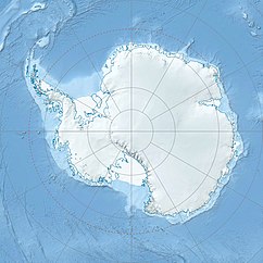
Mount Anakiwa is en 2.640 m över de See hogen Barg in Viktorialand, Oostantarktika. He liggt in de Mountaineer Range 5 km noorden von’n Mount Supernal.
De Noordgrupp von de New Zealand Geological Survey Antarctic Expedition (1966–1967) hett em na de Cobham Outward Bound School in dat neeseelandsche Anakiwa nöömt.
Weblenken
ännern- Mount Anakiwa in dat Geographic Names Information System von’n United States Geological Survey (engelsch)
- Mount Anakiwa op geographic.org (engelsch)
